The Technical Foundation
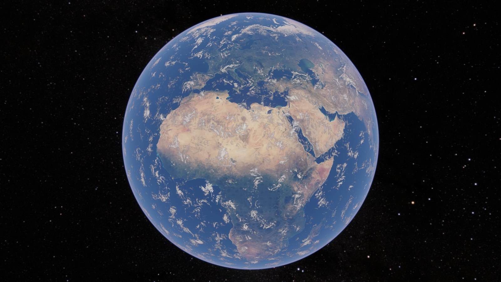
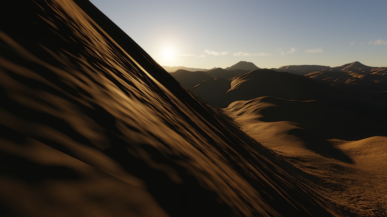
Magic renders the Earth from any height. Full disc at 15,000 km, a ridge at eye height, and every altitude between, with one camera, one world model and no mode switch. The terrain is measured (Copernicus GLO-30, GEBCO), the sky is physical, and the clock drives the sun, moon and stars. This post is the foundation everything else stands on: the stack, the precision rules, the chart, the frame, the data, and the way we work. Terrain and atmosphere get their own posts.
G6.Stack
Rust 2021, Vulkan 1.3 through ash, gpu-allocator, winit for the window and egui
for the panel. Shaders are GLSL 460, compiled at startup by shaderc to SPIR-V 1.6 and
reloadable from source while the app runs. The target is an RTX 4090 at 2560 × 1440.
The device features we depend on are the ones that make a bindless, compute-first design
comfortable: shaderFloat64 and shaderInt64, buffer device addresses, descriptor
indexing with update-after-bind, formatless storage images, timeline semaphores, scalar
block layout, dynamic rendering, synchronization2 and timestamp queries. We do not use
mesh shaders, ray queries, sparse residency or a second compute queue.
Every pass sees one descriptor set with two bindings — storage images and sampled
images, aliased per component type — and one push constant: the device address of this
frame’s FrameData plus a pass parameter. Everything else (tile slot table, CBT pool,
atmosphere parameters, feedback, stats) is reached through buffer_reference.
layout(set = 0, binding = 0) uniform image2D  gImages[];
layout(set = 0, binding = 1) uniform sampler2D gTextures[];

layout(push_constant) uniform PushConstants {
    FrameDataRef frame;   // address of this frame slot's FrameData
    uint passParam;
    uint pad;
} gPush;
#define FRAME gPush.frame.d
FrameData exists twice, once in Rust and once in GLSL. A test parses the GLSL struct and
checks every field offset against std::mem::offset_of!, and the renderer checks the
field count at startup. That check is not decorative: the first thing it did for this post
was refuse a stale binary with “the shader declares 211 fields, this binary has 210”.
Precision
Earth’s radius is 6.371 × 10⁶ m. An f32 at that magnitude has a ULP of 0.5 m, so a planet-centred f32 position is useless for a camera standing on the ground. The rules:
- CPU world and camera state are f64, planet-centred. X points at longitude 0, Y is north.
- GPU work is camera-relative. The camera sits at the origin of the render frame.
- The planet centre is never an f32 vector. The camera is described by
(up, h): its geodetic up vector and its height above the datum, each split into a hi and lo f32 so the f64 residual survives the trip.
let up = cam.position / dist;
let up_hi = up.as_vec3();
let up_lo = (up - up_hi.as_dvec3()).as_vec3();
let altitude = dist - planet.radius;
let altitude_hi = altitude as f32;
let altitude_lo = (altitude - f64::from(altitude_hi)) as f32;
Every ray/shell intersection is written in that form. The discriminant of the usual quadratic subtracts two numbers of size 10¹³; this one never does.
// Ray d from a camera h above the datum, against a shell of radius shellR.
bool shellIntersect(vec3 d, float shellR, float h, out float tNear, out float tFar) {
    float hs   = h + (FRAME.radius - shellR);        // height above this shell
    float rh   = shellR + hs;                        // distance camera - centre
    float cosA = -dot(d, FRAME.upHi) - dot(d, FRAME.upLo);
    float sinA = sqrt(max(1.0 - cosA * cosA, 0.0));
    float p    = rh * sinA;                          // perpendicular distance centre - ray
    float rmp  = shellR * (cosA * cosA) / (1.0 + sinA) - hs * sinA;   // shellR - p, no cancellation
    float disc = rmp * (shellR + p);
    if (disc < 0.0) return false;
    float s = sqrt(disc);
    float b = rh * cosA;
    float c = hs * (2.0 * shellR + hs);              // = |o|^2 - shellR^2, formed without |o|^2
    tNear = c / (b + s);                             // stable near root
    tFar  = b + s;
    return tFar > 0.0;
}
The same trick gives the height above the datum at any distance along a ray, which the
atmosphere integrators use; and the horizon dip at height h is asin(sqrt(h(2R+h))/(R+h)),
never acos(R/(R+h)).
Depth is reverse-Z with an infinite far plane, near / viewZ, and the near plane follows
the height above the displayed ground rather than the datum altitude, so a camera on a
summit keeps its depth precision where the geometry is.
The one place per pixel we spend f64 on the GPU is the chart lookup of a surface point.
GLSL has no double-precision trigonometry, so there is a hand-rolled atan64: halve the
argument three times with atan(y) = 2 atan(y / (1 + sqrt(1 + y²))), then a five-term
series. Error under 10⁻¹² rad, which is 6 µm on the surface.
The chart
The world is a cube sphere. Six faces, each a chart (u, v) ∈ [-1, 1]², mapped to a
direction by warping (u, v), placing the point on the face’s tangent plane and
normalising. The warp is the tangent warp at π/4 — x = tan(u·π/4) / tan(π/4) —
which makes the angle linear in the chart coordinate along the face centre line. Its
worst corner anisotropy is √3. We measured six projections (gnomonic, two tangent
variants, Everitt, COBE, QSC) before fixing this one; it is part of the world definition
and cannot change once tiles exist, because every stored tile address and every
per-tile inverse polynomial assumes it.
Tiles are 512 samples a side with a four-texel apron (520 stored), addressed by
(face, level, x, y). The texel size at a level is a closed form:
/// Metres per texel along the face centre line at `level`.
pub fn level_texel_size(radius: f64, level: u32) -> f64 {
    (radius * FRAC_PI_2) / (512.0 * (1u64 << level) as f64)
}
That gives 19.5 km at L0, 38 m at L9 (where the measured data stops) and 7.5 cm at L18. A point on a cube edge belongs to two faces; it is always evaluated on the lower-numbered one from both sides, so the two triangles meeting there get bit-identical positions. Before that rule there was a crack at the seam exactly one rounding error wide, and a ray through it went straight through the planet.
The frame
The renderer is compute-first and deferred. The only rasterisation is the terrain mesh (and, near the ground, ocean, trees and the canopy shell), and rasterising produces no colour: the fragment stage writes a hit record. Shading, sky, atmosphere and post are all compute.
hit0 = (t, height above datum, previous-height delta, level blend weight)   RGBA32F
hit1 = (slot, kind | flags | level << 8 | provenance << 16 | water << 24,
        texel.x bits, texel.y bits)                                          RGBA32UI
The recorded pass order, as PlanetRenderer::render lays it down:
- tiles — this frame’s tile uploads, then max-mip and normal derivation for them.
- atmosphere — transmittance and multiple-scattering LUTs if parameters changed; sky-view and aerial-perspective froxels every frame.
- cbt_update — the terrain mesh refines and coarsens (up to four iterations).
- cbt_draw — a depth-only pass selects the nearest triangle, then an
EQUAL-depth pass publishes the hit record. Depth ordering alone does not order storage writes. - vegetation, canopy — same pattern, into the same buffers.
- water_sky — settles what the mesh left: the analytic ocean where the published height is below the datum, and the sky, which is shaded here.
- ocean spectrum/FFT/surface, weather, cloud caches, cloud shadow, cloud columns.
- materials — virtual-texture page composition and per-pixel material resolve.
- shade — irradiance, terrain shadow ray, ocean, aerial perspective.
- pop — the surface-change counters read back one frame later.
- clouds (march, temporal, composite), taa, exposure and its same-frame guard, bloom, resolve, UI.
Two frames are in flight on timeline semaphores. Each pass sits between GPU timestamps, and the per-pass scopes are the columns of the telemetry CSV; a whole-frame timestamp pair is reported next to their sum so the unexplained remainder is a number rather than an assumption.
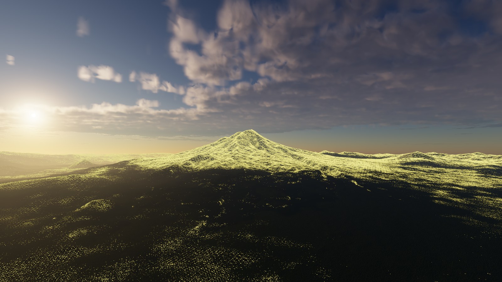
--near-wireframe), 2.6 km up near Mount Shasta. One concurrent binary tree, refined to a half-pixel residual.Data
- Elevation: Copernicus GLO-30 (and GLO-90 where that is all there is), converted to a block pyramid on disk from L2 to L9. A block is 2048 texels square, exactly 4 × 4 tiles, and a block texel is a tile texel — indexed, never resampled. GLO-30’s 31 m lands on L9’s 38 m.
- Bathymetry: GEBCO, stored through L6 (463 m onto a 305 m texel) and interpolated above. The DEM’s 30 m coastline is in charge where the two meet.
- Climate: a WorldClim-derived map — annual temperature, monthly temperature spread, effective precipitation, mean height, wind — read by materials, snow, haze humidity and the weather field.
- Colour: NASA Blue Marble, one packed BC1 cube per month, 20,480 texels a face, selected by the simulation month. The plain edition, without NASA’s baked hillshade, because we light the surface from our own normals.
Everything above L9 is a fixed function of the L9 tile. No generated level is ever the input to another; that is the subject of the terrain post.
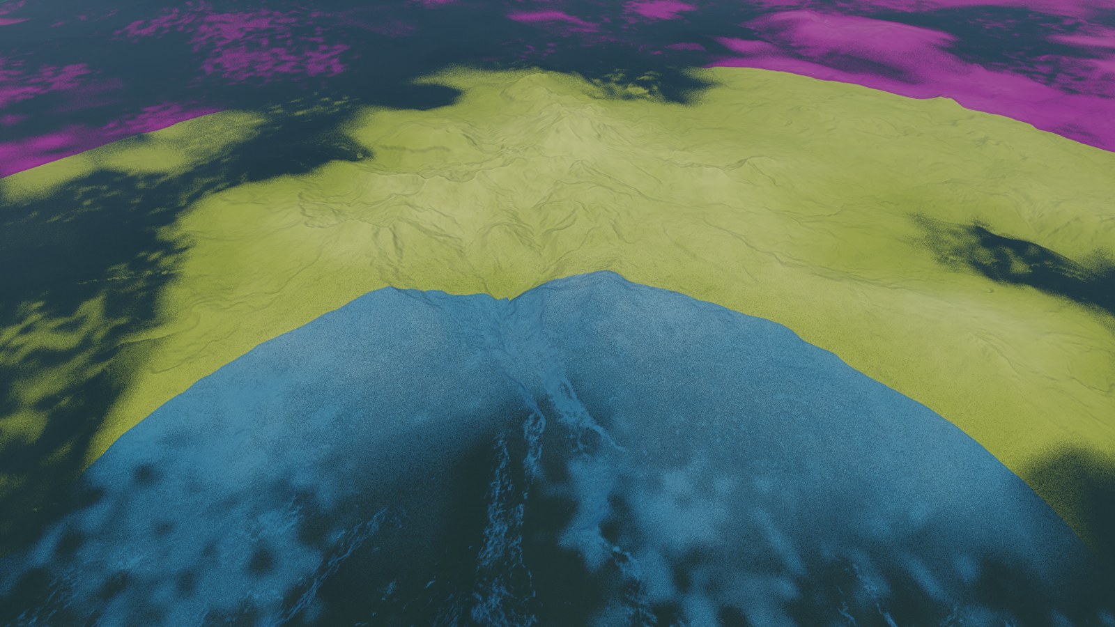
--level-tint) from 10 km. A level boundary is a ring at constant ray distance.Where it lands
Measured on the 4090 at 1440p with atmosphere, shadows, materials, TAA and the panel on, current as of 2026-09-11: an orbit-to-ground descent with a landing hold runs at a frame p99 of about 13 ms; a ground hold at eye height about 12 ms. The terrain mesh holds a few thousand triangles at orbit, about 54,000 at 400 km and about 1.75 million at eye height, in a 2²²-entry pool (673 MiB). The tile cache is 1,024 slots (3.2 GB, fixed at startup); the whole renderer sits at about 4.25 GiB of device memory.
How we work
Two people, distinct jobs. Kaliffen owns the project: direction, scope, and the judgement on how something looks. Astra designs and writes the code. A short process document binds both, and the rules that matter most for the engineering are these:
- Design and task are one mapping. A design section no task points at is not being built. A task with no design section is not defined.
- Code owns its definitions. Sizes, strides, offsets and schemas are read from source, never copied from a document. (Every number in this post was checked that way.)
- Experiments run through the harness. A measurement is a scenario file plus an
existing verb —
run,ladder,compare,baseline,gate,images,hits. The harness is Rust and shares the engine’s types; Python may render a report but never produces a verdict. The engine writesrun.jsonbeside everyframes.csv: commit, dirty flag, source and shader hashes, GPU, driver, resolved settings. - A comparison needs three runs a side, or it is inconclusive. Quantiles are not additive; per-pass p99s are never summed into a stack p99.
- Settle is a named operation: zero pending source jobs, zero uploads, zero fine-detail gain, held for a declared number of frames — and it reports which criterion blocked if it did not converge.
The catalogue of views is a Rust table, not a folder of JSON. --golden G6 places the
camera on the steepest slope within 5 km of a named anchor at golden hour, with the sun
computed from the astronomy model for that site on 2000-06-21. Every image on this site
is one of those ids or a camera file the same code wrote, and the caption names it.
That is the foundation. Next: the terrain — one mesh from orbit to contact.